Flood Hazard Mapping using Remote Sensing and GIS Techniques
(A Case Study of Majuli River Island, Assam India)
ABSTRACT :
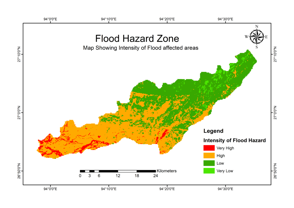
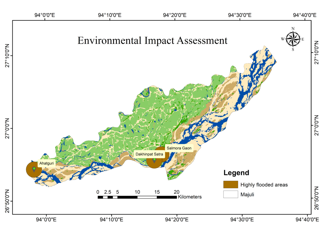
Majuli is a river island in the Brahmaputra River, Assam which is the first is land to be made a district in India. It is the largest district bounded by river Subansiri on the Northwest and by river Brahmaputra on the South, Southwest. Flood is the most devastating and frequent disaster in North-East India, resulting in loss of human life and damage of properties. The physical and socio-economic condition of the inhabitant of the river island is affected by such an event. Flood disasters have become a menace affecting the socio-economic, environmental, health and safety of the people. The current study introduces the methodology of flood hazard zonation using various tools and techniques. Monitoring and mapping out flood prone areas, assessing the extent of coverage is thus not in existence and this has been a problem for the government and the entire emergency agencies. However, this literature uses remote sensing and GIS as an emerging tool to detect the entire flood hazard/prone areas to address and improve the efficiency of flood monitoring, and mapping. A SRTM Remote Sensing Data acquired through the SRTM website for making a flood hazard map with the help of GIS analysis tools and the acquired DEM which shows the topography and elevation of the state. This study provides an easy, simple and short technique for producing flood hazard zonation from various satellite data by using Geographic Information System (GIS) tools